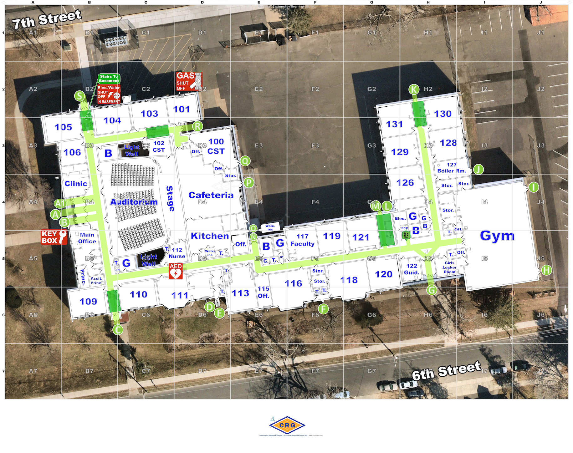

School Digital Mapping Project
The Delaware Emergency Management Agency (DEMA) provides accurate and uniformed maps for all of Delaware's nineteen public school districts and charter schools, enabling law enforcement and first responders to react swiftly during emergencies in unfamiliar environments.
The Comprehensive School Safety Program at DEMA invested almost $1 million to enhance school security statewide to Delaware's nineteen public school districts and charter schools. Delaware's General Assembly provided the funding as part of a $10 million allocation to the School Safety and Security Fund, which was originally established in 2018. Under the bill, $1 million was provided to the Department of Safety and Homeland Security for "school mapping, reporting application, and threat assessment tools."
DEMA partnered with the Critical Response Group (CRG), a New Jersey-based firm specializing in collecting and digitizing school building blueprints using the same tactical and operational framework as highly trained military units.
Every second counts — this enhanced visual tool makes unfamiliar environments easy to understand, both reducing response times and improving incident command and control during emergencies..
The digital school maps feature detailed information on floor plans, as well as high-resolution imagery of the entire campus. In a crisis, the goal is to equip first responders with critical information needed to quickly coordinate response actions both inside and outside of school facilities. The maps are also used to facilitate school drills, interagency training exercises, and coordinate post-emergency reunification processes.
These school maps come in a sharable and readily accessible format for school officials, emergency personnel, and law enforcement, and are continuously maintained by cooperating agencies conducting periodic walk-throughs and campus visits.
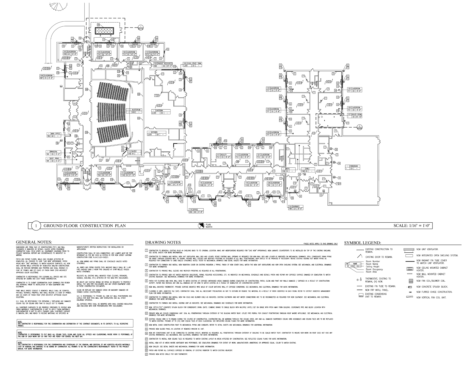
Before and After
School Map BEFORE
School Map AFTER